
Occupancy Mapping
Problem Statement
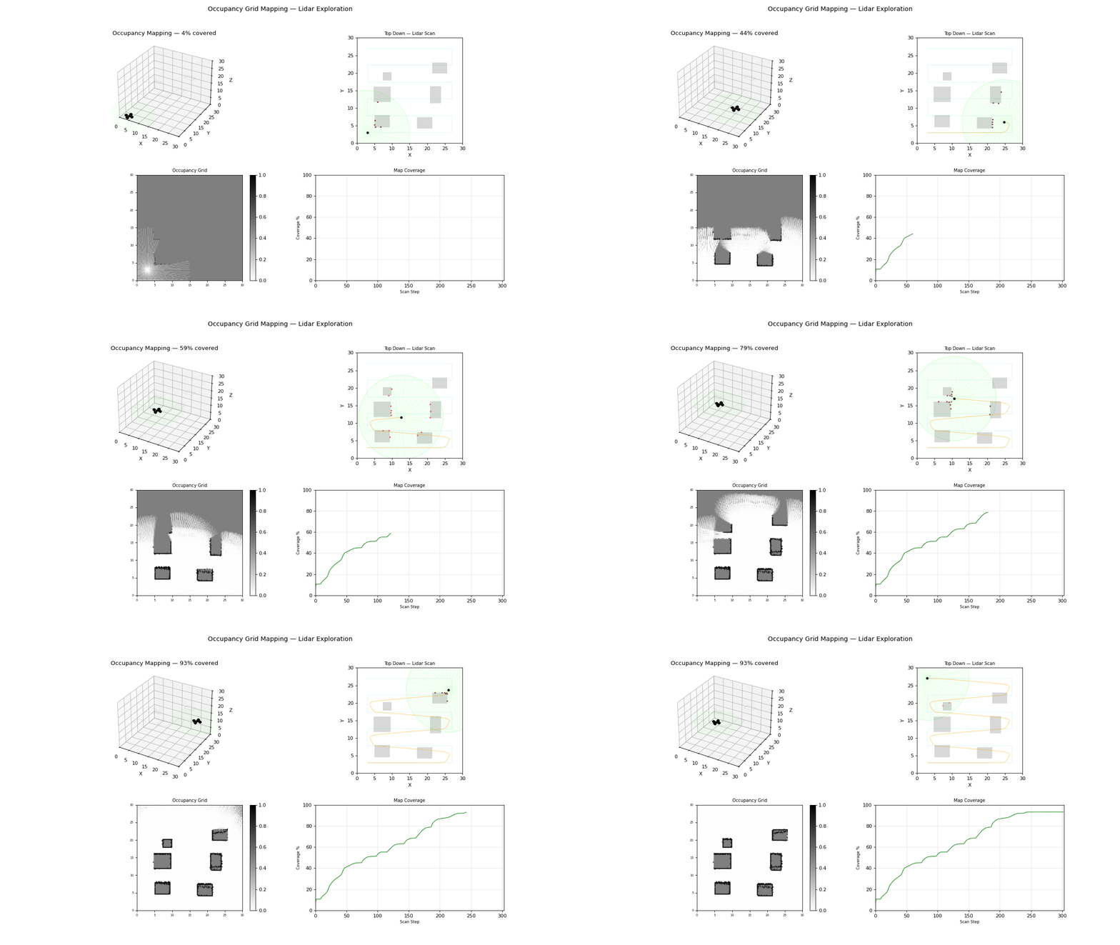
Occupancy mapping converts range observations into a probabilistic spatial model for collision checking and navigation. It underpins path planning and local obstacle avoidance.
Model and Formulation
Log-odds update for each cell:
Probability recovery:
Algorithm Procedure
- Ray-cast each lidar measurement through the grid.
- Mark traversed cells as free and endpoint as occupied.
- Update log-odds with inverse sensor model.
- Export occupancy map to planning modules.
Tuning and Failure Modes
Beam angles are body-referenced; the vehicle heading has to go in too. Integrating every scan as though the vehicle pointed along
+xproduces a map that is correct only while it flies straight and smears progressively as it turns.Treat a range near the sensor maximum as a no-return. Range noise pushes a genuine miss just under the limit, and marking that cell occupied paints a phantom obstacle at the edge of every scan — a ring of false wall around the vehicle. Gate the occupied update with a margin.
Log-odds must be clipped, or the sigmoid overflows once a cell has been seen enough times.
Incorrect sensor model causes inflated false positives/negatives.
Dynamic obstacles can leave ghost occupancy without decay logic.
Grid resolution too coarse obscures narrow passages.
Implementation and Execution
python -m flybots.simulations.perception.occupancy_mappingEvidence
References
- Thrun, Burgard, Fox, Probabilistic Robotics
- Elfes, Occupancy Grids for Mobile Robot Perception and Navigation (1989)